Technology for good: identifying real-time mangrove loss through the Global Mangrove Watch in the Rufiji Delta
Tanzania hosts East Africa’s largest mangrove forest, spanning 53,255 hectares, in the Rufiji Delta. The mangrove ecosystem here is a vital habitat for important wildlife, including at least 437 bird species, fish such as snappers and groupers, large animals like crocodiles and hippos, and crustaceans like crabs and shrimps. The mangroves are, in fact, responsible for 80% of Tanzania’s annual prawn harvest.
But this ecosystem is not just critical to biodiversity. As all mangroves globally do, Tanzania’s mangroves shield its coast from tropical storms and coastal flooding, providing a vital line of defence against shoreline erosion. The Rufiji Delta and its surrounding landscape is also the primary national hotspot for blue carbon storage, making this area crucial to climate mitigation as well as adaptation.
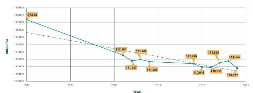
Despite these benefits, the mangroves are continually degraded at alarming rates, exposing coastal communities and biodiversity to adverse climate change impacts. While at least 60% (>57,000 ha) of all mangroves in Tanzania are within protected areas, including the Rufiji Delta Mangrove Forest Reserve, Tanzanian mangroves decreased by 5.6% (6,608 ha) between 1996 and 2020. The main driver of loss in the Rufiji Delta has been conversion to rice farming, where there is an influx of freshwater from the Rufiji River. After four or five seasons, these farms are abandoned, and others are established.

Forest rangers from Tanzania Forest Services (TFS) and village natural resource committee (VNRC) members make frequent patrols to monitor the status of mangroves in the Rufiji Delta, noting areas that experience drastic loss and/or degradation, and to try to halt the expansion of rice farms in the Delta to take the pressure off the remaining mangroves. These patrollers rely primarily on tip-offs from concerned citizens and fisherfolk, who visit the mangroves as part of their daily routines.
A big challenge has been verifying such alerts before site visits, where, in some instances, no substantial disturbances warrant concerns, resulting in unnecessary costs that strain the already limited resources required for patrols.
But things have changed now with the advent of Global Mangrove Watch alerts.
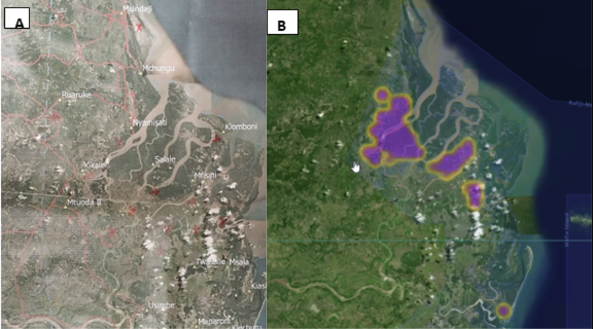
Global Mangrove Watch (GMW) is an online platform that gives near real-time information on where and what changes there are to mangroves across the world. With hi-res information on topography, soil conditions and hydrology, GMW gives the evidence needed to respond to illegal practices, pinpoint the causes of local mangrove loss and track restoration progress. GMW now publishes monthly loss alerts with over 90% accuracy, showing that pristine mangrove areas in the Rufiji Delta continue to be converted into rice farms.

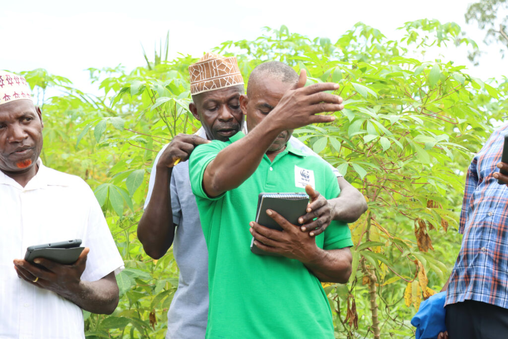
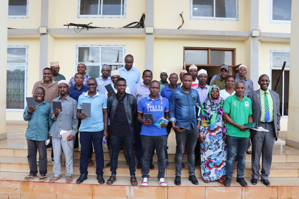
To make best use of GMW in the Rufiji Delta, Wetlands International trained 25 participants, comprising Tanzania Forest Service officers and village natural resource committee members on using the change alerts functionality. These alerts have provided relief to the monitoring teams, who now are more confident about site visits from disturbances verified using this remote sensing technology.
Once a loss has been determined, community members and local governments can begin the process of restoration, particularly of the abandoned rice fields affected by illegal logging. Invasive climbers are weeded out and where propagules are not abundant, enrichment planting is undertaken. These kinds of restoration methods often allow for natural regeneration of the mangrove forest.

Wetlands International has also supported alternative livelihood initiatives in the delta such as beekeeping, poultry farming, and the making of tie-and-dye clothing materials. We have piloted sustainable rice farming plots outside the mangrove area on abandoned land and following dialogues with farmers and other local stakeholders, the Kibiti District Council has allocated farmers land outside mangrove areas.

With the new GMW alert functionality, mangrove loss can therefore be determined with greater accuracy, and steps can be taken to restore the degraded ecosystem with haste, saving time and money.
This work is implemented by Wetlands International, with support from WWF and IUCN (Mangrove Capital Africa and Save Our Mangroves Now projects)

