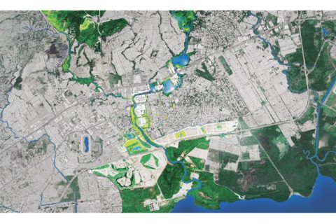
Living with water & wetlands: flood risk reduction in Panama City
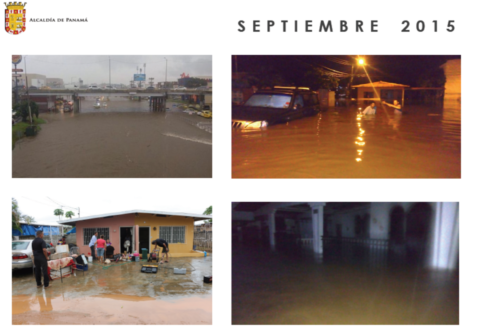
Every year between June and December, the wet season in Panama brings, to the communities of Panama City, the risk of flooding. As a country, Panama ranks 1st on the Local Disaster Index of Latin America (IDB 2010) with flooding causing 86.9% of reported economic losses and 34.5% of all mortality (between 1990-2014). The rapid urbanisation of Panama City has resulted in most of these risks being concentrated here. Of the 236,006 people living in 75 flood-prone neighbourhoods, 50,932 inhabitants (21.5%) live in the densely populated subdistrict of Juan Diaz. Since 1990, it has been listed as the country´s most vulnerable area, with adjacent Tocumen and Pacora listed 4th and 8th.
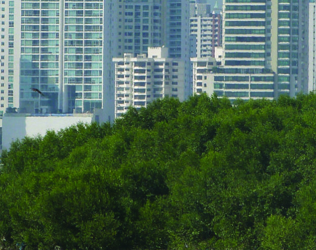
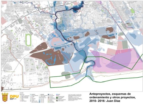
The Juan Diaz sub-district is a low-lying area separated from the sea by a large strip of mangroves, currently protected by law as a Ramsar Site of International Importance. A larger river runs through it alongside numerous smaller streams and creeks. Most of them have been encroached upon and channelled into gutters and drainage systems that are poorly maintained and have become urban garbage dumps. Meanwhile, much of the floodplains, wetlands and surrounding mangroves have been landfilled up to a height of 6 meters. When heavy rains fall, these landfills divert the water to the lower lying neighbourhoods such as Juan Diaz where, In the period 1990-2013, 155 flooding events were recorded and since 2008 flooding has further intensified. the situation is made worse by upstream urbanization, which, has caused sedimentation of the river and streams and reduced rainwater infiltration. The result? Increased surface water runoff and a larger volume of water flowing through rivers and streams with a reduced capacity and nowhere to drain in the lower part of the basin. To make matters even worse, the area suffers from a badly maintained urban drainage system that is further challenged by the disposal of garbage in the canals.
Upon request by the Municipality, a Dutch Risk Reduction team organized a Scoping Mission to evaluate ways to address the flood risk problems in Panama City. The mission consisted of experts of the Dutch water sector and was supported by Wetlands International. One of the key recommendations given to the municipality was to start Water Dialogues. These dialogues would provide a platform to initiate a new process of water management. What is more, the platform could facilitate a learning process, new possibilities for stakeholder cooperation and help to optimise initiatives on the three levels of water governance (content, institutional, relational).
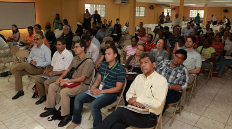
Stakeholders
The stakeholders engaged in the Water Dialogues included;
- Community groups and representatives (Juan Diaz sub-district neighbourhood association, representatives from Santa Ines neighbourhood),
- Private developers with interests in the area,
- National authorities (Ministry of Environment, Ministry of Public Works, Ministry of Housing and Spatial Planning, Bay of Panama Sanitation Project, among others),
- Local authorities (communal boards, different municipal departments),
- Knowledge Institutes (Universities, research institutes),
- NGOs.
Results
The main tangible result of the dialogue process was an Action Plan, which includes (grey and blue-green) infrastructural works such as dikes, walls and wetland reservoirs to reduce the flood risk. To prevent inadequate and unplanned construction in flood risk zones, the Action Plan details various regulatory adjustments, including municipal agreements, legal tools and a Risk Zone Map.
Importantly, the dialogues restored the trust of affected communities in (municipal) authorities to solve the problem of flooding. The negative discourse where each party blamed the others and lack of reflection on own behaviour transformed into a constructive process to identify the real root causes of the flooding problems, and take joint action. For the private sector (developers) participants, dialogue and a hydrological study (financed by IDB), showing the impact of the landfills on flooding, helped bring about a realization of responsibility in flood prevention and the necessity for a change in the regulatory framework. For (municipal) authorities, the dialogues resulted in improved cooperation.
Financial support from IDB also allowed the Spanish consultancy IH Cantabria, to design infrastructural works to prevent flooding in the Juan Diaz watershed.
Community action to clean existing drainage systems yielded immediate benefits. The heavy rains caused by Hurricane Otto, in November 2016, ended up having a minor impact in the neighbourhoods.
The Santa Ines neighbourhood was host to a pilot project testing how communities, private developers and the city government can turn a problem into an opportunity to apply Living with Water principles in the city.

Challenges ahead
The current work of the Municipality, aided by Wetlands International, focuses on the adoption of new regulations and additional building requirements for flood-prone areas. At the same time, the Municipality, through a loan from the Inter-American Development Bank (IDB) will tender the design, build and maintenance of infrastructural works reducing flood risks, estimated at USD 100 million. An intermediate stakeholder involved “intermediate tender design phase” could significantly reduce tender risks. These require the formation of a consortium with construction companies, urban designers and social and environmental specialists. These are roles that Wetlands International and ONE could fulfil.
